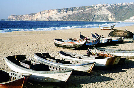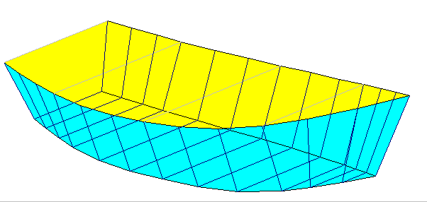

Comment faire un « portuguese dinghy »? Dédicace aux Albarquelles!
Plein de plans en libre accès ici, amusez-vous bien! / For wood moths eh eh! Free plan here! Have good times!
https://freeww.com/boat-plans.html
(emilie bateau)


Comment faire un « portuguese dinghy »? Dédicace aux Albarquelles!
Plein de plans en libre accès ici, amusez-vous bien! / For wood moths eh eh! Free plan here! Have good times!
https://freeww.com/boat-plans.html
(emilie bateau)
Salut! -english below –
Pour naviguer, la météo utilisée est l’imprimé donné au port le matin + j’utilise des cartes papiers et un sandow (un tendeur elastique épais) pour tenir la barre le temps d’aller faire le point quand je navigue seule. Mais, sur mon téléphone portable (un android de base) deux appli font un confort de nav ok quand les conditions se compliquent. Voici:
Pour avoir cette appli: téléchargez l’application gratuite opencpn à partir d’internet ou du playstore, rechercher la version avec le Logo en forme de losange. Puis il vous faut rajouter une carte mémoire SD sur votre téléphone pour augmenter sa capacité de stockage – environ 10 euros dans une grande surface – puis téléchargez les cartes marines gratuites en tapant ‘CM93 2009’ dans Google ou en allant ici: https://drive.google.com/drive/folders/0B1t9Xm6aEz_Tc25SYWdyTFJLZFU
Dézippez et enregistrez le téléchargement CM93 sur votre carte mémoire SD. Ensuite, vous allez dans OpenCPN > boite à outils > cartes et données et vous indiquez au logiciel où est-ce que vos cartes sont stockées. Puis cliquer sur Ajout de dossier. Puis allez dans la clef à molette>affichage>cartes et cochez « activer affichage en mosaïque ».
Couvrez votre portable avec un préservatif ou achetez une pochette étanche transparente pour être tranquille. Si vous partez en nav de suite, l’appli NAVIONICS avec toutes les cartes intégrées est gratuite 15 jours. Après il faut acheter des cartes. Isailor et qtVlm sont deux bonnes appli sûres avec cartes intégrées moins chères que navionics (comptez 30 E par grandes zones de nav)
A essayer aussi: l’appli sailgrib AA permet de paramétrer une alarme de mouillage. Vous enregistrez votre position et choisissez un rayon de sécurité. L’appli sonne si votre bateau dérape.
Bonne nav!
(emilie bateau, fait avec certaines données du site net de pierre lavigne )
Hello!
To navigate, the weather used is the print given to the port in the morning + I use paper charts and a thick elastic to hold the stick the time to do a GPS point when I’m sailing alone. But, on my cell phone (a basic android) two apps make a nav comfort ok when conditions get complicated. Here:
To have this app: download the free app opencpn from the internet or from the playstore, search for the version with the Diamond Logo. Then you need to add an SD memory card on your phone to increase its storage capacity – about 10 euros in a big box – then download the free charts by typing ‘CM93 2009’ in Google or by going here: https: // drive.google.com/drive/folders/0B1t9Xm6aEz_Tc25SYWdyTFJLZFU
Unzip and save the CM93 download to your SD memory card. Then you go to OpenCPN> Toolbox> Maps and Data and you tell the software where your cards are stored. Then click on Add Folder. Then go to the wrench> display> cards and check « enable tiled display ».
Cover your phone with a condom or buy a transparent waterproof cover to be dry. If you go sailing immediately, the NAVIONICS app with all integrated maps is free for 15 days. After you have to buy cards. Isailor and qtVlm are two good safe apps with integrated cards cheaper than navionics (count 30 E per large nav areas)
Try it too: the sailgrib app AA allows setting an anchoring alarm. You save your location and choose a security radius. The app rings if your boat skids. eh eh!
(emilie boat – done with some data from the net site of pierre lavigne)